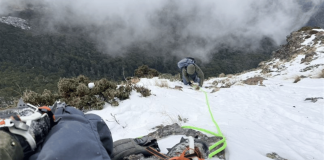

Plot of land twice the size of Toa Payoh reclaimed at Pulau Tekong
Singapore has completed the main construction works for its first polder project, reclaiming 800 hectares of land at Pulau Tekong, according to a joint press release on Monday (8 Aug) by the Housing and Development Board (HDB) and Public Utilities Board (PUB).
The plot of land — about the size of two Toa Payoh towns — is located at the north-western tip of Pulau Tekong.
This marks the nation’s first polder project, which involves reclaiming land below mean sea level.
With the reclaimed land slated for military training purposes, more space on the mainland can be delegated to other uses, such as developing new homes and amenities.
Source: Public Utilities Board
Infrastructure designed to combat rising sea levels & rainfall
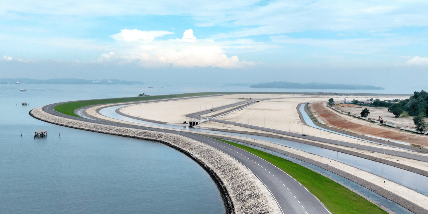
Described as a “significant engineering milestone for Singapore“, the project involved designs and construction solutions to manage rising sea levels.
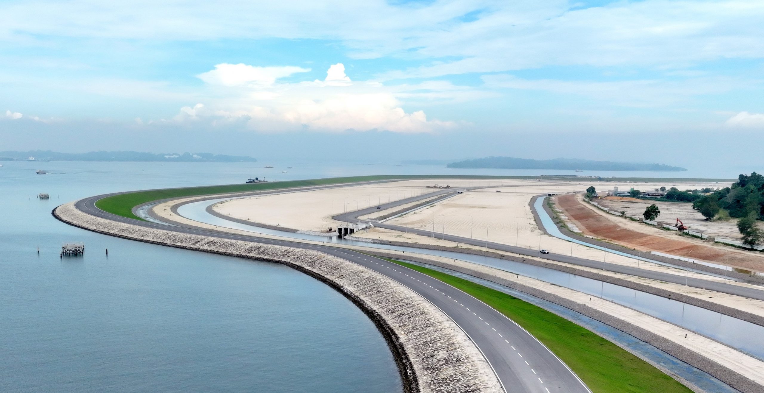
To provide protection from the sea, a 10km coastal dike has been constructed along the perimeter of the polder.
Source: Public Utilities Board
The dike currently stands at 6m above sea level at its highest point. However, it can be raised to accommodate future sea levels.
“The coastal dike was the first key infrastructure to be completed, as it was necessary to fully enclose the area being reclaimed to manage water levels within the polder,” the agencies said.
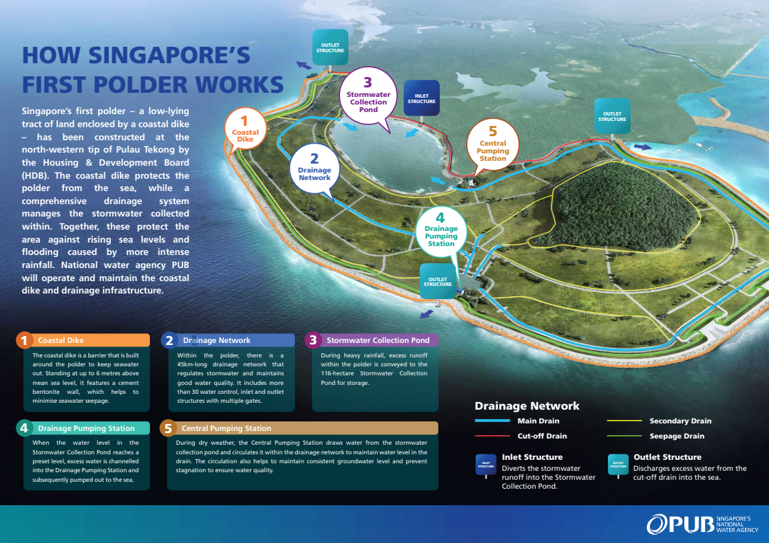
As stormwater runoff is an issue that “requires special attention”, the authorities have built a water management system that includes a 45km network of drains and two pumping stations.

Source: Public Utilities Board
Additionally, a stormwater collection pond the size of 2,000 Olympic-sized swimming pools mitigates flooding within the polder.

Source: Public Utilities Board
Singapore’s first polder project
This is Singapore’s first time reclaiming land below the mean sea level.
As opposed to adding materials to reclaim land above sea level, the empoldering process involves building a coastal dike and draining water from the area intended for reclamation.
Most importantly, empoldering reportedly uses almost 50% less sand compared to the traditional process of infilling with sand.
The project was first announced by then-Minister for National Development Lawrence Wong in 2016.
On Monday (8 Sept), Mr Wong visited the site of the polder.
“Operating the polder will give us valuable insights into how we can protect our coasts and build resilience against climate change,” he wrote in a Facebook post. “It will also provide the SAF with more training areas, while freeing up land on the mainland for other development needs.”
Also read: MS Explains: How Generative AI’s shocking energy & water use is hurting the planet
MS Explains: How Generative AI’s shocking energy & water use is hurting the planet
Have news you must share? Get in touch with us via email at news@mustsharenews.com.
Featured image adapted from Public Utilities Board.